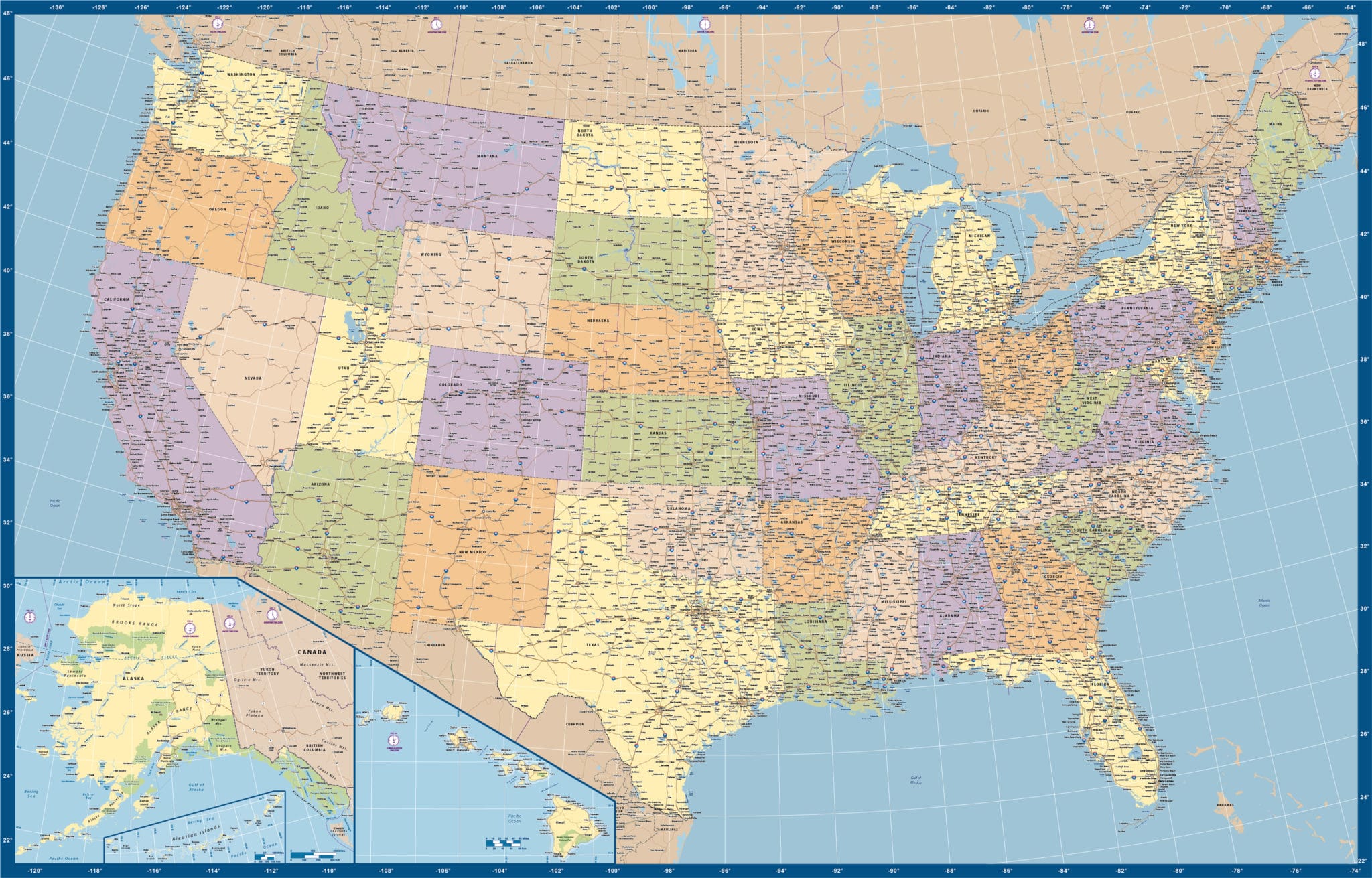
USA Deluxe (More Colors)
Price: $295.00
Item # 2506
USA Deluxe Map is highly detailed with even small cities and US Highways, and differentiates states by color.
Our digital Detailed Deluxe USA map with more colors is currently 50.0″ by 32.0″, but it can be scaled up to full wall map size. This edition of our deluxe map is for those who want color differentiation between states. With great labor and seasoned intuitive savvy, we’ve managed to make this map both highly detailed and spacious—without the use of insets. Zoom into this map and see the tens of thousands of micro problems our cartographers delighted in solving. We can also print, laminate or mount any of our vector maps. Contact us for options and pricing.
Creative Force Maps:
- You always receive both the Adobe Illustrator and PDF files immediately.
- Fully-Editable and logically layered.
- High-Resolution vector maps.
- Royalty-Free.
Layer Directory
- Hawaii Inset
- Aleutian Inset
- Alaska Inset
- Coordinates
- Map Border
- Time Zone Clocks
- State Text
- Int’l Admin Text
- Water Text
- Interstate Hwy Text
- Interstate Hwy Symbol
- Text – State Capital
- Text – Pop – 250K
- Text – Pop – 100K
- Text – Pop – 50K
- Text – Pop – 25K
- Text – Pop – 10K
- Text – Pop – 5K
- Text – Pop – 1K
- Text – Pop – 1
- City – State Capital
- City – Pop – 250K
- City – Pop – 100K
- City – Pop – 50K
- City – Pop – 25K
- City – Pop – 10K
- City – Pop – 5K
- City – Pop – 1K
- City – Pop – 1
- Int’l City Text
- Int’l Town Text
- Int’l City
- Int’l Town
- Tollway Center
- Freeway Center
- Tollway
- Freeway
- Primary Road
- Int’l Tollway
- Int’l Freeway
- Int’l Primary Rd
- Int’l Secondary Rd
- International Boundary
- Time Zones
- State Boundary
- Graticules
- Water Area
- State Area
- Int’l Water Area
- Int’l Area
- Ocean Background
